A Different Perspective of Thanksgiving: Praying Towns of Southern New England

Introduction
Between 1616–1620, nearly three-quarters of the Wampanoag nation died. In the 1600s, epidemics and diseases brought from European traders hit Native communities along the Northeast Coast. Huge swaths of Native communities were decimated both before and after the Mayflower’s arrival in 1620.
This interactive map is based off of a map in Wilkie and Tager’s Historical Atlas of Massachusetts, “Late 17th Century Native Resettlement in Southern New England,” which shows the landscape of Puritan proselyting activities in the late 1600s.
Upon clicking “Native ‘Praying’ Towns,” indicated with a cross, one can read the historical writings of Daniel Gookin, a magistrate of Massachusetts colony (Source). This man considered himself a defender of Native people who converted to Christianity and settled ‘Praying Towns.’ It’s clear through his writing the prejudiced views colonizers held. Read below for more context.

*Note: I’ve respectfully changed the historical use of the word “Indian” to Native after reading “The Impact of Words and Tips for Using Appropriate Terminology: Am I Using the Right Word?"
Historical Context
This excerpt is from “The Thanksgiving Tale We Tell Is a Harmful Lie. As a Native American, I’ve Found a Better Way to Celebrate the Holiday” by Sean Sherman and provides an overview of the origins of Thanksgiving.
“It was the Wampanoag in 1621 who helped the first wave of Puritans arriving on our shores, showing them how to plant crops, forage for wild foods and basically survive. The first official mention of a “Thanksgiving” celebration occurs in 1637, after the colonists brutally massacre an entire Pequot village, then subsequently celebrate their barbaric victory.
Years later, President Washington first tried to start a holiday of Thanksgiving in 1789, but this has nothing to do with “Indians and settlers, instead it’s intended to be a public day of “thanksgiving and prayer.” (That the phrase “Merciliess Savage Indians” is written into the Declaration of Independence says everything we need to know about how the founders of America viewed the Indigenous Peoples of this land.) It wasn’t until the writer Sarah Josepha Hale persuaded President Lincoln that the Thanksgiving holiday was needed and could help heal the divided nation that it was made official in 1863. But even that was not the story we are all taught today. The inspiration for that was far more exclusionist.
According to the 2009 book, Thanksgiving: The Biography of an American Holiday by James Baker, who was a researcher at Plimoth Plantation, this changed during the Progressive Era (1890–1920), when the United States became a global power rife with industrialization and urbanization. It saw a rise in nationalism, as European immigrants poured into the country, and the Protestant Americans who’d massacred indigenous people feared being displaced.
Colonial ideology became the identity of what it was to be truly “American,” and they began implementing teachings to clearly define “Americanism” for the new immigrants. One of these was the sanitized story of Thanksgiving — which fabricated a peaceful depiction between the colonizers and the tribes and neglected to mention the amount of death, destruction and land-grabbing that occurs against the first peoples, setting the tone for the next 200 years.
By 1920, writes Baker, the story of “pilgrims and Indians” became a story every American school child was taught, even in Native schools.”
These excerpts from Douglas S. Brown’s piece in the Commonwealth Beacon of Massachusetts give a picture of Daniel Gookin and the relationships between Native communities and colonizers.
“…Tensions between the Native Americans and the English settlers increased steadily after that first Thanksgiving and eventually erupted in 1675 into what is known as King Philip’s War. The war was fought between the English and several Native American tribes under the leadership of Massasoit’s son Metacom, or King Phillip, as he was known to the English. He became the sachem of the Wampanoags after the death of his father and brother. The war lasted for 14 months and, by population, it remains the bloodiest and most savage war in American history.
Thousands of lives were lost, houses were burned, and 12 entire towns were completely destroyed. It took the colonies over 50 years to fully recover. But the losses were most severe on the Native American side. More than half of the 20,000 or so in southern New England either perished or were sold into slavery.
Enter Daniel Gookin. He was a so-called assistant in the government of the Massachusetts Bay Colony, one of 18 magistrates who worked with the governor and deputy governor to run the government.
…Gookin worked closely with John Eliot, the apostle to the Indians, and together they supported and fiercely defended these Praying Indians throughout King Philip’s War. The Praying Indians supported the English in the war, often serving as scouts and putting their own lives on the line to help the cause.

And for this, they were horribly persecuted by both sides. King Philip’s followers saw them as traitors and the English mistrusted them due to the color of their skin. As a result, the Praying Indians were rounded up during the war and sent to Deer Island in Boston Harbor where hundreds would eventually be left to die of starvation and exposure to the bitter cold.
…The plight of the Praying Indians was a horrible tragedy that would be mostly unknown to history if Gookin had not written it down. He wrote in great detail about all the injustices and abuses carried out, mostly by the English; what he called the Doings and Sufferings of the Christian Indians in New England. He sent his manuscript to his sponsors in England to be published. His sponsors were part of a philanthropic corporation that was set up to propagate the gospel among the Indians in New England. But they refused to publish Gookin’s manuscript. It simply didn’t comport with the English narrative at the time.
It sat in England undiscovered for over 150 years, until it eventually made its way back to Worcester, where it was published in 1836 by the American Antiquarian Society, a learned society and research library established in 1812 by revolutionary patriot and printer Isaiah Thomas.
Additional Learning Resources
- The “First Thanksgiving”: How Can We Tell a Better Story?
- Timeline from “The “First Thanksgiving: How Can We Tell a Better Story?”
- Wamponoag Language Restoration Project
- John Eliot: Father of “Praying Villages”
- Eliot, Gookin, and the Magunkaquog
- Begin at the Beginning: Daniel Gookin, Praying Indians, and America’s Bloodiest War
- Daniel Gookin, The Praying Indians, and King Philip’s War: A Short History in Documents
- Images of Gookin’s writings
How I created this visualization in Kumu
I got the idea for this visualization when I stumbled across Wilkie and Tager’s original map on a Smithsonian website dedicated to Native knowledge.

Looking for more information on “Praying Towns,” I discovered Gookin’s writings had been digitized (text, photographs), and I knew this would make a great tool for interacting with the history of Puritan settlement in Southern New England.
What makes this visualization different than a lot of Kumu projects? I’ll discuss two aspects:
- Use of a background image
- Use of icons
Background image:
Instead of using Kumu’s geo underlay, I wanted to use a map with the same defined areas as Wilkie and Tager’s original. I went to google maps and turned off all the layers except for state lines, then took a screenshot.
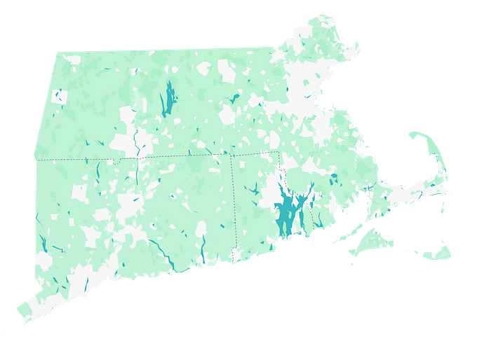
After isolating just that same Southeast New England area in my image (I erased the water and the surrounding states in Photoshop), I went to our Kumu documentation to learn how to upload this image to my Kumu project and use it as a background, not an interactive element:
Kumu docs: Add a background image
The premise is to add a new element, give it a name, and then in the advanced editor, define that element to be in the background through its layer, sizing, and turning the label off.
#background-2 {
  layer: background;
  shape: rectangle;
  height: 2450;
  width: 2450;
  color: transparent;
  image-size: contain;
  image-resolution: original;
  label-visibility: none;
}

element["label"="background 2"] {
  image-url: url(https://s3.amazonaws.com/cloud.kumu.io/accounts/28543/993957/269d139e-9204-4417-a054-b46737938e4d.png);
}
I uploaded the image into the description box,

which gave me a url for the image. In the second code block, I pasted that image-url in to define that as the image for my background element. And voila! We have a background image to which we can pin other elements!
Icons
For the Major English settlements, Native “Praying Towns” and Native Reservations, I wanted to stick to the same general premise of Wilkie and Tager’s map. They indicated praying towns with a cross, so I used icons to do the same in Kumu.
Kumu docs: Add icons to elements
All elements in Kumu have a field for defining “element type.” I differentiated each of the three types of locations into the same categories as Wilkie and Tager: Major English settlements, Native “Praying Towns” and Native Reservations.
Then, in the code, you can say, for this element type, I want to use this icon (you can get the name from the Font Awesome icon library), and define its color and size. For “Praying Towns” I used the icon label “cross,” and for the English settlements and Native Reservations, I used the icon label “map-pin.”
element["element type"="Native 'praying' towns"] {
  icon: cross;
  icon-color: black;
  color: transparent;
  size: 30;
}

element["element type"="Native reservations (post-1674)"] {
  icon: map-pin;
  icon-color: black;
  color: transparent;
  size: 30;
}

element["element type"="Major English Settlements"] {
  icon: map-pin;
  icon-color: #9e0142;
  color: transparent;
  size: 30;
}
Additional Tweaks
- The names of the towns were overlapping with each other and hard to read, so I turned element labels off but used popovers to show the names when your mouse hovers over them.
- When you use icons, those icons don’t show up in the legend. So I created an image of the legend using the same typeface we use in the Kumu interface (Proxima Nova), and uploaded that as an image control.
@controls {
  bottom-left {
    image {
      src: "https://s3.amazonaws.com/cloud.kumu.io/accounts/28543/993957/05bc5d3b-e4d5-49f6-b581-67f6e4885dbd.png";
      height: 120;
    }
  }
}- In order to facilitate interaction when someone is reading the description of a praying town in the left hand column, I used town names in double brackets as a widget, for example, [[Quantisset]], which showcases that element on the map.
- I made the background color of the visualization match the color of the water, and made it so that you can’t zoom too far out:
@settings {
   background-color: #62B7BE;
   scale-min: 0.5;
}
You can see all of these settings in the advanced editor of my project (Settings button, then “switch to Advanced Editor”).

Reach out if you have any questions, or need help on your own project! I love to see Kumu being used as an interactive learning tool, and hope that this project is useful for helping people understand the true historical context of Thanksgiving in the USA.
p.s. There is a project reviving the Wampanoag language! We’re passionate about language preservation on the Kumu team ;) Read more about their efforts and support them here.

